Trail maps from
Redwood Hikes Press
Redwood Hikes maps are based on my experience hiking the North Coast and the Bay Area. They’re mainly intended for hiking and are drawn at a scale of 1:25,000.
- Areas of old growth redwoods are shaded in dark green.
- Footbridges, memorial groves, and stairs are shown to help you keep track of your location.
- Trail distances are marked.
Printed maps
All printed maps are on waterproof plastic, except the Sequoia and Kings Canyon map is on regular paper.
Orders are shipped each weekday at about 7 am. All orders are sent by USPS first class or priority mail and usually arrive 2 days after the ship date for addresses in northern California, 3 days for other US locations, or 1 week for international shipments.
Mobile maps
Mobile versions are available for iOS and Android through the Avenza Maps app.
- Mobile maps look like scans of the printed maps.
- Once they’re downloaded to your device you don’t need cellular reception to use them.
- The maps show your current location on the map; tracks can be recorded and the length of the track shown.
- Pinch-to-zoom makes it easier to see small features.
- See Avenza’s Redwood Hikes Press page for a complete listing of available maps.
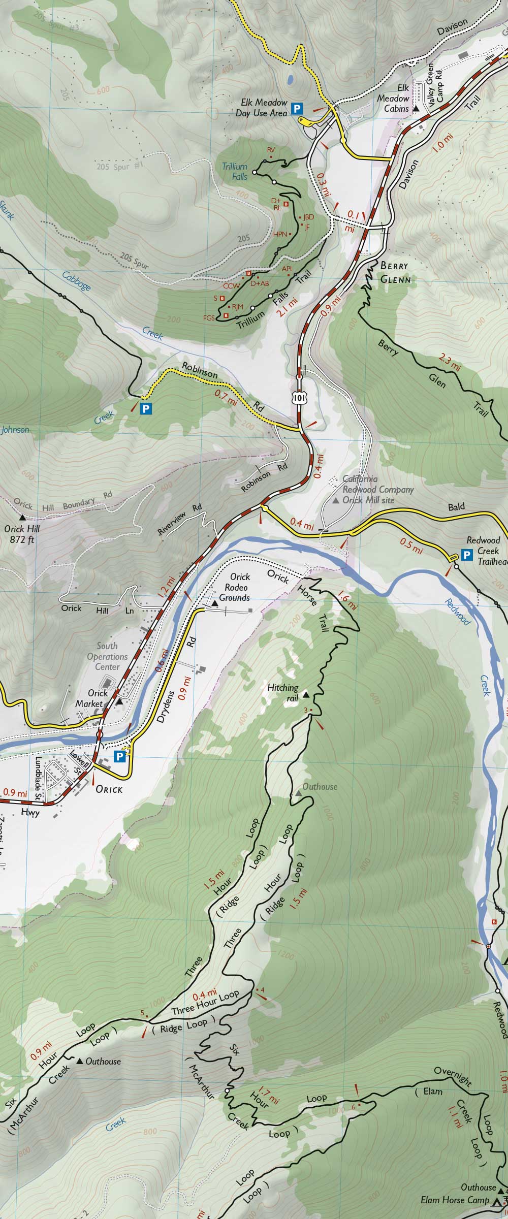
Part of the Redwood National and State Parks map