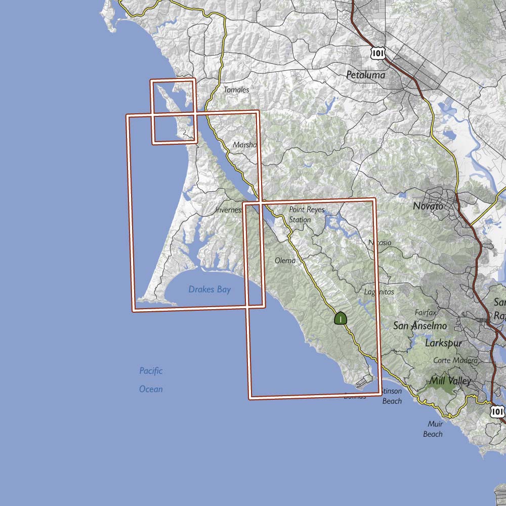
Rectangles indicate map coverage
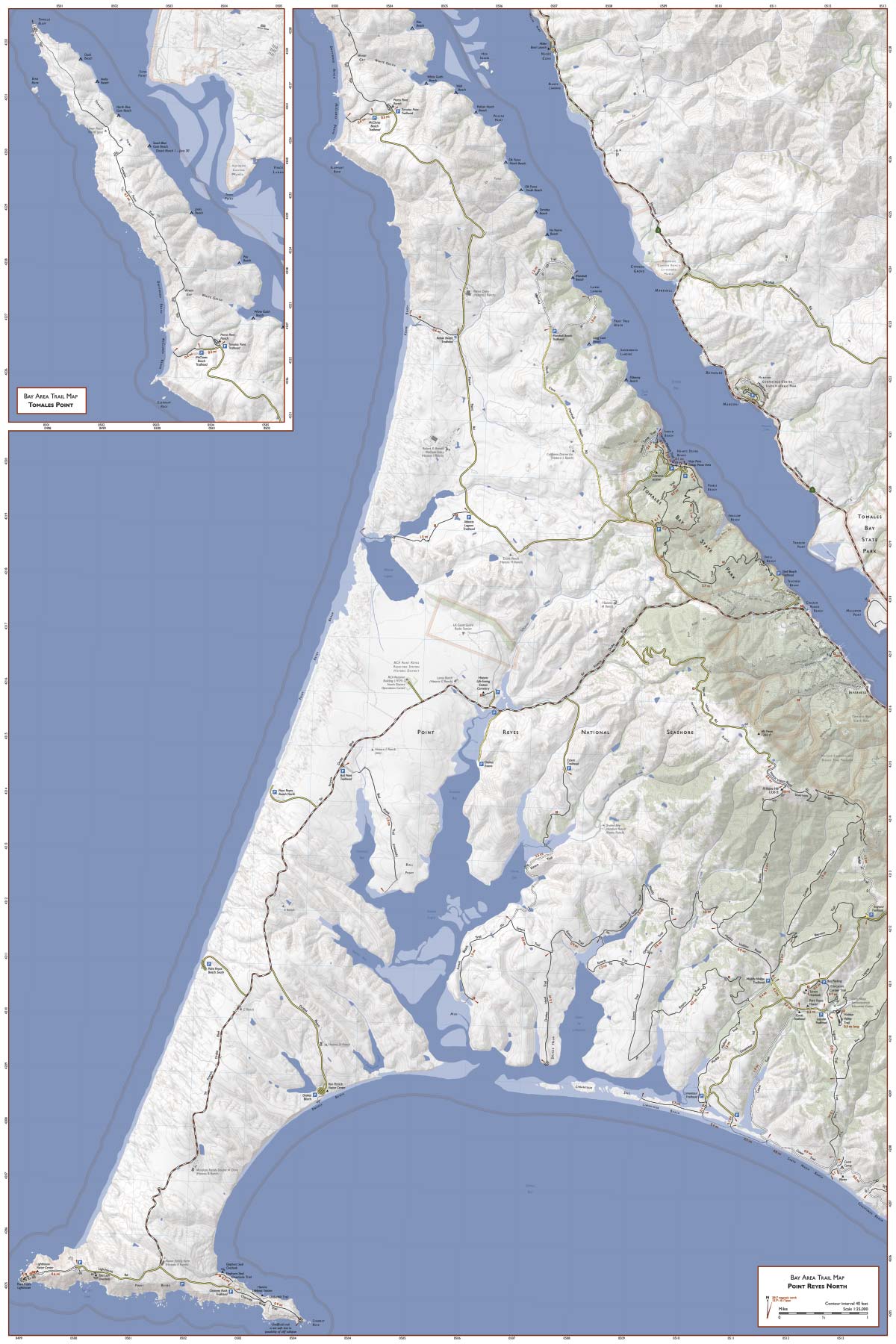
Front of map (click to enlarge) |
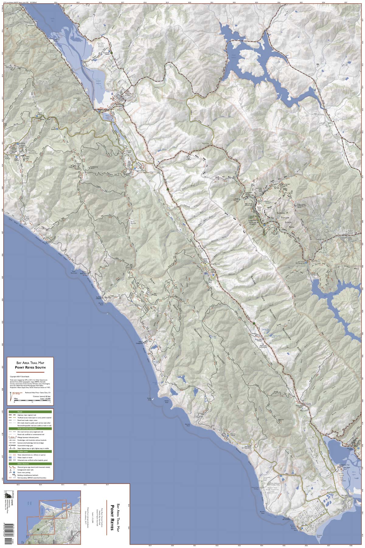
Back of map (click to enlarge) |
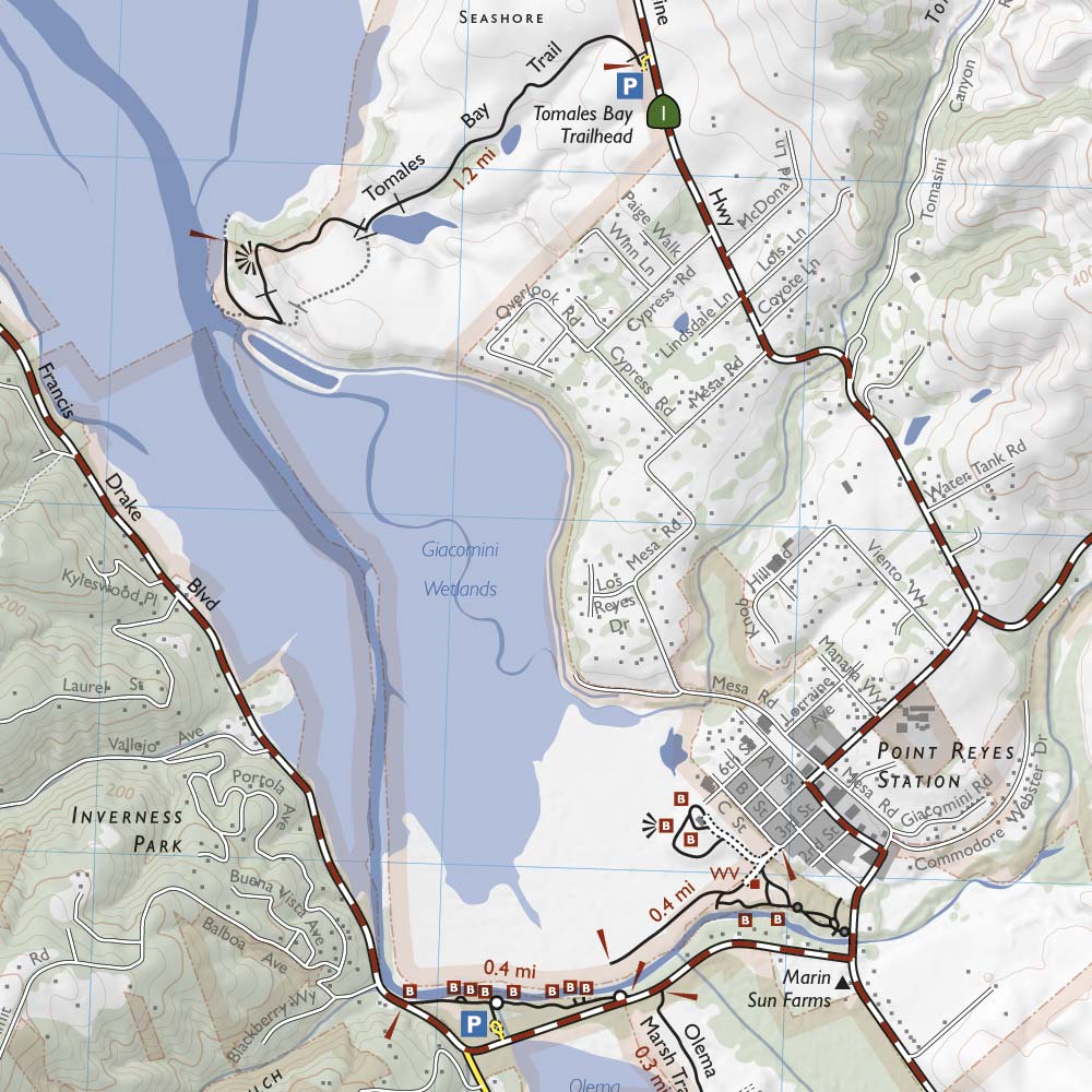
Part of the map (actual printed size of this area is 5 x 5")
This map includes Point Reyes National Seashore, Tomales Bay State Park, and Samuel P. Taylor State Park.
This is the most detailed trail map of Point Reyes available for purchase; it’s drawn at a significantly larger scale than other printed trail maps of the area. All official hiking trails were drawn from newly-acquired GPS data with a resolution of about 100 feet. Memorial grove markers, footbridges, panoramic viewpoints, and stairs are shown. Most roads are shown and labeled. In addition, unofficial trails and dirt roads are shown and are greyed out to distinguish them from official hiking trails. We don’t recommend that you use these trails, but if you accidentally wander onto one, having it on the map will help you get back on track.
Wooded areas are indicated in green, developed areas in grey, and 40 foot contour lines are shown. Trail distances are marked and a UTM grid is provided to help with GPS navigation.
Rectangles indicate map coverage
|
Front of map (click to enlarge) |
Back of map (click to enlarge) |
Part of the map (actual printed size of this area is 5 x 5")