
The Bay View Trail
This lovely waterside park with its eucalyptus-shaded roads, rolling grasslands, and pretty bay views is the most enjoyable of all the parks on San Francisco Bay. It’s the only bayside park that has miles of shaded trails and a wide variety of scenery.
The sound of gunfire from the Richmond Rod & Gun Club can be heard in the western half of the park, especially if the wind is blowing from the south. The noise didn’t used to be noticable, but the club has been a lot busier since Anthony Chabot Regional Park’s marksmanship range closed in 2016.
There are two entrances; both charge a $3 parking fee on weekends from April through October. Of the two, the newer Atlas Road entrance is by far the nicest and most convenient, but the older Giant Highway entrance is still popular.
The park has miles of flat, easy trails, but the bayside trails around the edge of the point are the most scenic and enjoyable.
Click map to show all roads and trails
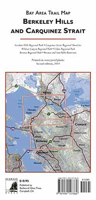
Part of the Berkeley Hills and Carquinez Strait trail map from Redwood Hikes Press (second edition, 2017)
Here’s the trailhead location in Google Maps and Google Street View.
Start at the parking lot at the end of Atlas Road. It’s a little difficult to get oriented; from the signboard next to the restroom building, go left on the Cook’s Point Trail, which is the more open of the two trails that pass by the parking lot.
Continue straight and cross the paved Pinole Point Trail. Descend to the Bay View Trail, which has the best bay views of the hike, including some great views of the Marin mountains across the bay.
The views are interrupted for a while as the trail dives into an attractive eucalyptus grove for a quarter-mile or so, but the road eventually re-emerges onto the shoreline.

A eucalyptus grove on the Bay View Trail

The Bay View Trail
At the point, take the short, unmarked singletrack trail to stay near the shore and descend to the base of the fishing pier.
Turn right onto the paved Pinole Point Trail, which passes through some shady picnic areas. This is the park’s most popular trail, and a shuttle runs along it taking people to and from the pier. Although it’s very enjoyable, take the quieter Owl Alley Trail, which runs through an open meadow before turning into a stately eucalyptus-lined allée.

The Owl Alley Trail

The Owl Alley Trail
Turn left onto the Marsh Trail. The views on the north side of the point aren’t as scenic as the south side, but there’s still a nice variety of different views.

The Marsh Trail
Turn onto the Cook’s Point Trail, which runs through a dense, dark eucalyptus grove, then arrives at the parking lot.
Point Pinole used to be the site of a gunpowder and dynamite plant; the eucalyptus trees were planted to contain explosions. After the plant closed in 1960, NASA proposed to use the site for a Mission Control complex. A few years later Bethlehem Steel began building a major steel mill, but abandoned its plans due to increasing competetion from imported steel.
The tracks for the Disneyland railroad came from Point Pinole, where they were at one time used to haul explosives.
© 2018, 2023 David Baselt