
The Sky Trail has nice views of Carquinez Strait
Crockett Hills is a long, narrow park that’s mainly used by mountain bikers because it has five miles of flow trails specifically designed for mountain biking. These trails are fairly scenic, especially the ridgetop Soaring Eagle Trail and the wooded Tree Frog Loop, but they aren’t very enjoyable for hiking because of their excessively long switchbacks.
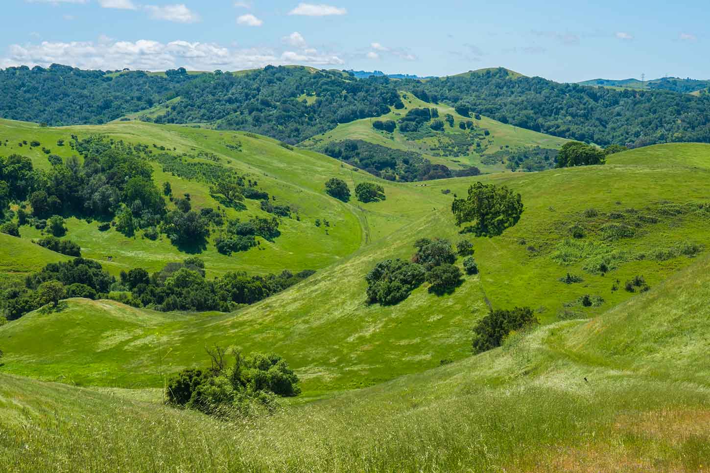
The best trails for hiking are in the isolated, difficult-to-reach interior valley at the south end of the park. Unfortunately, most trails in this area — everything south of the Tree Frog Loop — are closed for habitat protection from about February through August, which would be the best time to visit. The dates vary and the closures are never posted on the park website. These trails are so little-used that in recent years they’ve almost completely disappeared.
The route described below is one of the few hiking options that doesn’t use the flow trails and is open year-round. However, part of the loop at the south end may no longer be usable, since it’s disappeared due to lack of use.
Click map to show all roads and trails
Part of the Berkeley Hills and Carquinez Strait trail map from Redwood Hikes Press (second edition, 2017)
Here’s the trailhead location in Google Maps and Google Street View.
Start at the parking lot just outside the small industrial town of Crockett. After going through the gate, don’t follow the obvious trail ahead, but immediately turn onto the much less-prominent trail to the right. The trail climbs steeply up a wooded hillside; there’s a little poison oak near the top.

The Crockett Ranch Trail
After passing through a tunnel under Cummings Skyway, the trail leaves the woods and emerges onto an exposed ridgetop, which is the most scenic and popular part of the park. The Sky Trail climbs along the ridge, where there are some nice views of Carquinez Strait and its mismatched bridges. It’s pretty nice in spring, but in summer, if the park has been grazed, the ridgetop can become unpleasantly dusty, barren, and covered with dried-out flecks of manure.

The Soaring Eagle Trail, one of the park’s flow trails, from the Sky Trail
The trail climbs to a picnic area on an open hilltop, then begin to descend. After a gate, turn onto the Big Valley Trail, which makes a short but steep descent into the valley.

The Big Valley Trail in the interior valley
Follow the Big Valley Trail through the valley until it reaches the little-used Kestrel Loop Trail. The trail is marked with a signpost, but in the spring it may be so overgrown that it’s almost invisible.
A few yards before the road reaches the park boundary, a singletrack connector trail branches off and climbs to another dirt road. However, the connector trail isn’t marked and has completely disappeared. If the fire breaks have been mowed recently it may be possible to use the much more promenent, but steep, fire break that follows the park boundary; otherwise it might be necessary to wade through the grass to reach the upper dirt road.
The upper half of the loop trail is rough and overgrown, but it’s much easier to follow than the lower half. It continues to climb, providing some nice views of the valley below and the hills to the west before cresting a ridge and descending back to the Big Valley Trail.
The Kestrel Loop Trail in April. Click to see the trail in June.
Return on the Sky Trail.
Crockett Hills was little-used until its mountain bike flow trails were built in 2015, turning the park into one of the best places in the East Bay for mountain biking. For a while the park was mobbed as cyclists came from all over to try out the new trails, but when it started raining the surface was churned into an unpleasantly bumpy mess by cows, and everyone stopped coming for a few years. Since then, the trails have been restored and it looks like the area is no longer grazed in winter. The park has regained some of its former popularity, but it’s not overly crowded any more.
This article from Bermstyle has some nice pictures of what the mountain bike trails looked like when they were first built.
© 2018, 2023 David Baselt